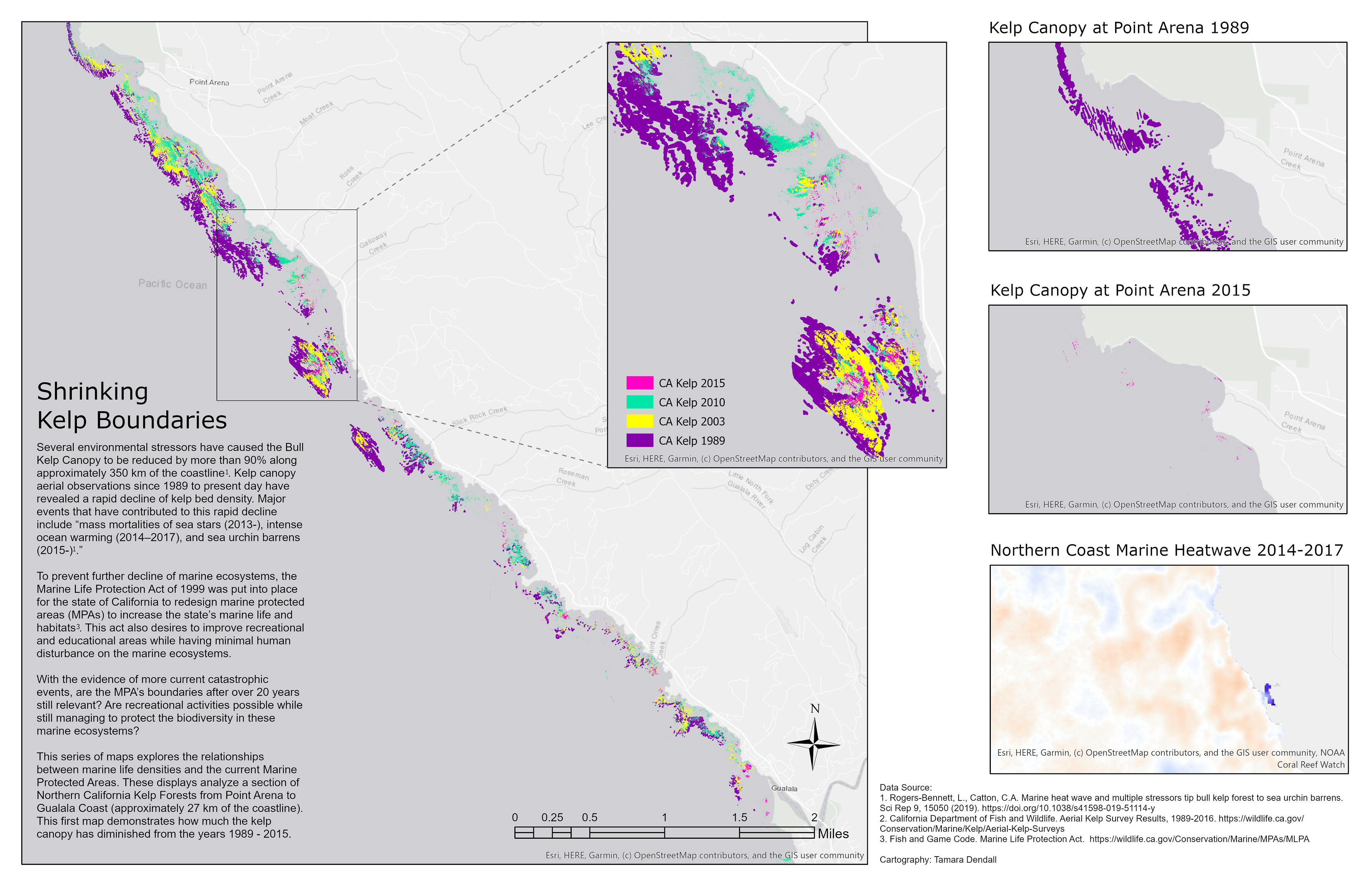
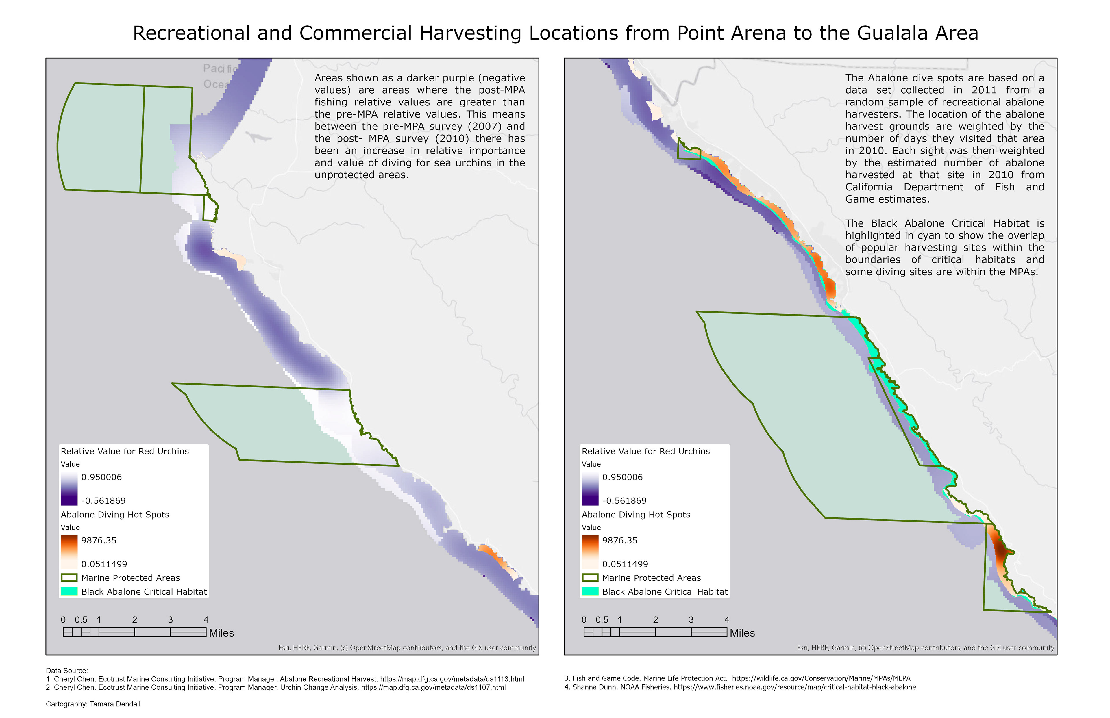
This series of maps was created to explore information on the decline of the Pacific Coast Kelp Forest Canopy along a 27 km portion of the Northern California Coastline. With ArcGIS, collected data was analyzed and visualized to demonstrate how kelp forest density has changed over the course of 26 years. These maps also considered if the established Marine Protected Areas have had any effects on the red urchin and rockfish populations within this region.